1 Alabama
Geography

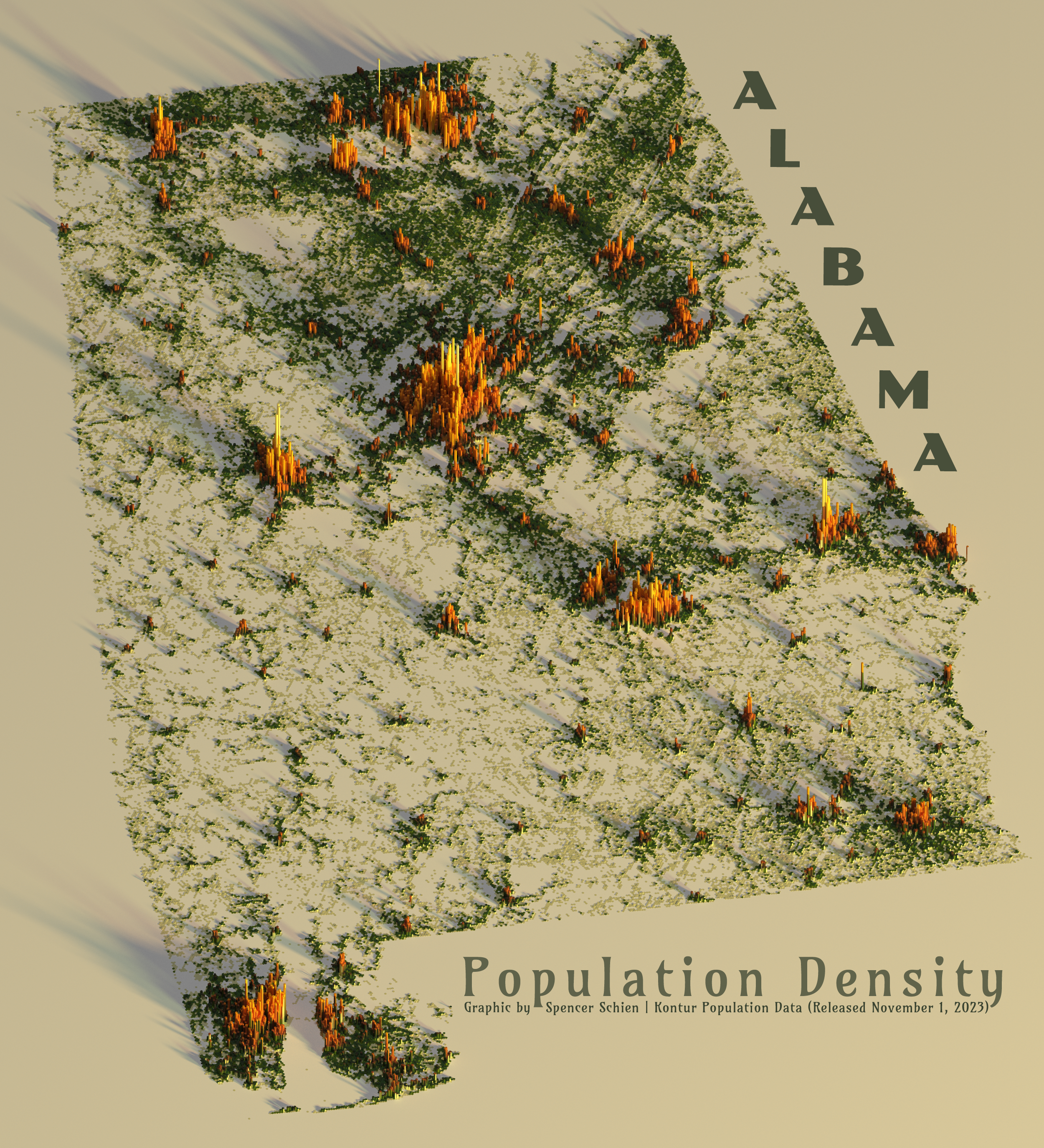
Alabama, the Heart of Dixie. Located in the southeastern United States, Alabama’s geography includes both the southern end of the Appalachian Mountains and a small bit of coastline along the Gulf of Mexico.
Both of these geographical features are apparent in the population density map of the state. Population patterns in the northeast of the state show striations that coincide with mountain ridges, and to the south, the Gulf Shores area and Mobile Bay are clearly visible.
Areas of Note
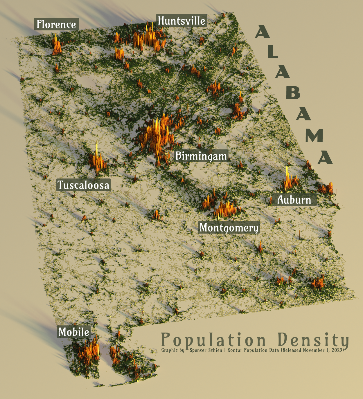
Alabama’s capital is evident as the most populated area of the state…JK! Birmingham jumps out as the most populous urban area (and smack dab in the middle of the state, at that), but the capital, Montgomery, registers as less than a college town.
Interestingly, the northeast region of the state, characterized by the southern tail of the Appalachian Mountains, shows broader general population than the southwest (aside from Mobile area). This southwest region largely coincides with the East Gulf Coastal Plain geological section of Alabama.
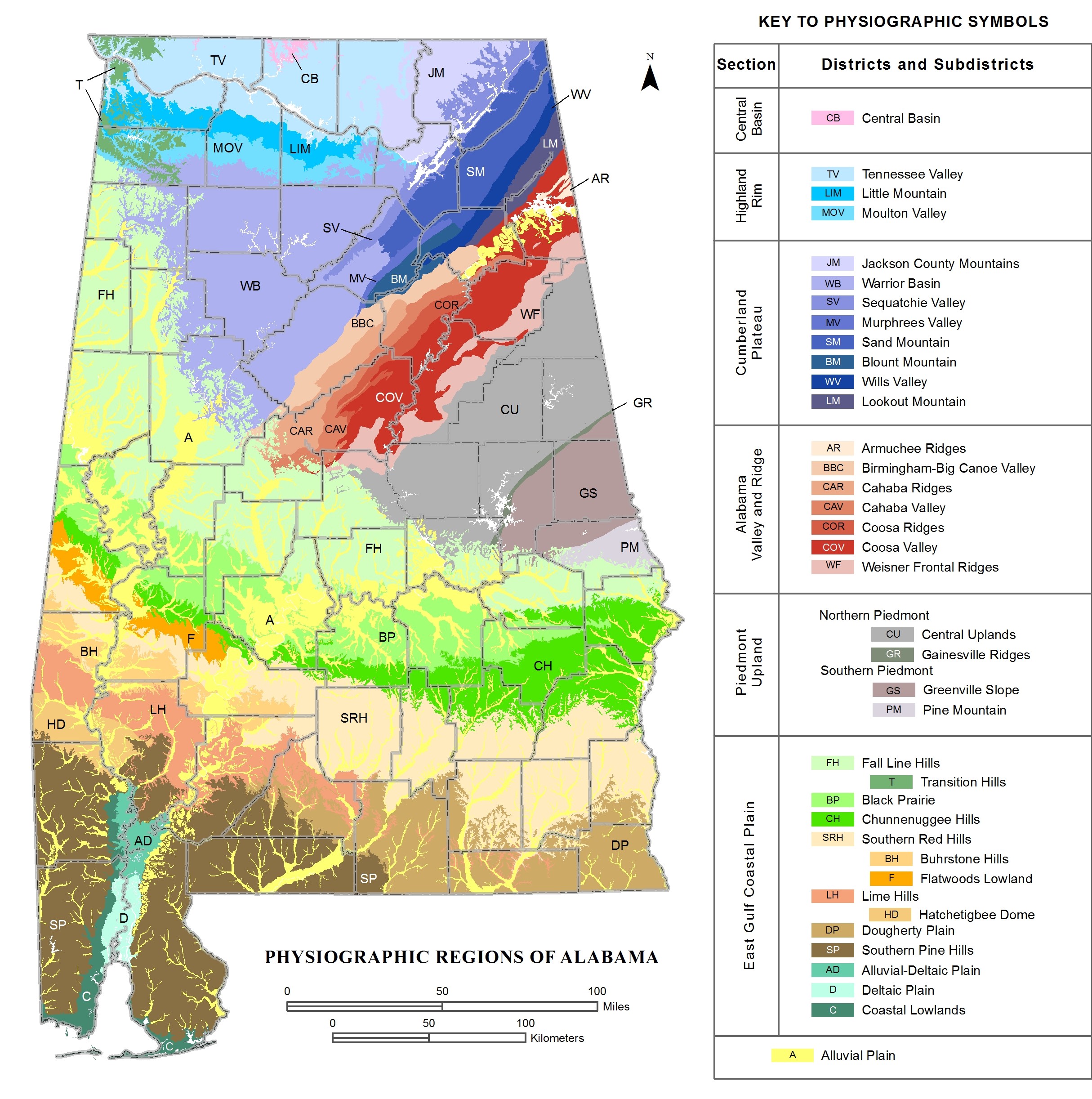
The fertile soil of this area attracted the development of cotton plantations in the 19th century, and these plantations were worked by enslaved African Americans. After the civil war, many of these freed slaves stayed in the area–to this day, the population of the Black Belt is majority Black, lending additional meaning to the term.
So, to sum up, this southwest coastal plains region has traditionally been devoted to agriculture, a land use that is inherently low-density. Add on top of that the social and political ramifications of slavery and the civil war, one of which being the great migration of African Americans from the southern United States to the north in search of better opportunities.
I think that gives us a pretty good idea as to why this region is more sparsely populated.